LETL AD 2 AERODROME DATA
AERODROME LOCATION INDICATOR AND -NAME
LETL - TERUEL
AERODROME GEOGRAPHICAL AND ADMINISTRATIVE DATA
ARP |
402443N 0011303W. See AD 2-LETL ADC. |
|
Distance and direction from the city |
12 km NW. |
|
Elevation |
1026 m / 3367 ft. |
|
Geoid undulation |
52.07 m ± 0.05 m. (1) |
|
Reference temperature |
32ºC. |
|
Low average temperature |
4ºC. |
|
Magnetic variation |
1ºE (2025). |
|
Annual change |
9.2'E. |
|
AD administration |
PLATA (Plataforma Aeroportuaria Teruel) - Consorcio del Aeropuerto de Teruel. |
|
Address |
Aeropuerto de Teruel; 44396 Caudé (Teruel). |
|
TEL |
+34-978 617 742 |
|
FAX |
+34-978 617 538 |
|
AFTN |
LETL |
|
Approved traffic |
VFR. |
|
Remarks |
Requests for commercial passenger operations PPR 12 HR by e-mail operaciones@aeropuertodeteruel.com (1) For all AD points. |
OPERATIONAL HOURS
Airport |
HR AD (Public use):
Other public use hours PPR 24 HR (1). HR AD (Restricted use):
Other restricted use hours PPR 24 HR (2). |
|
Customs and Immigration |
HR AD PPR 48 HR. |
|
Health and Sanitation |
No. |
|
AIS |
H24 (3). |
|
ARO |
H24 (4). |
|
MET briefing |
HR AD. |
|
ATS |
No. |
|
Fuelling |
HR AD. |
|
Handling |
HR AD. |
|
Security |
HR AD. |
|
De-icing |
HR AD. |
|
Remarks |
(1) It will be possible extend this schedule or open the airport on holidays and/or weekends by request sent to airport operations operaciones@aeropuertodeteruel.com 24 hours in advance. (2) The airport may open on holidays, weekends and/or at night time by request sent to airport operations operaciones@aeropuertodeteruel.com 24 hours in advance. (3) Centralised AIO Office - International NOTAM Office.
(4) Centralised ARO Office Geographical Area 3.
|
HANDLING SERVICES AND FACILITIES
Cargo facilities |
No. |
|
Fuel types |
JET A-1, 100LL (1). |
|
Oil types |
AEROSHELL W100, ESSO 100-120 (1). |
|
Refuelling capacity |
No. |
|
De-Icing facilities |
Service provided by the airport. |
|
Hangar space |
No. |
|
Repair facilities |
No. |
|
Remarks |
(1) Service provided by BP Oil España, S.A.U.
|
PASSENGER FACILITIES
Hotels |
No. |
|
Restaurant |
Food and beverage vending machines and meal service on weekdays. |
|
Transportation |
Taxi. |
|
Medical facilities |
First aid. Defibrillator. |
|
Bank/Post Office |
No. |
|
Tourist information |
Yes. |
|
Remarks |
None. |
RESCUE AND FIREFIGHTING SERVICES
Fire category |
Public use HR AD: 5. Restricted use HR AD: Restricted use aerodrome resources. |
|
Rescue equipment |
In accordance with the fire category published. |
|
Removal of disabled aircraft |
Truck cranes external to the AD, with maximum hoisting capacity of 120 TM, for moving aircraft of up to types B737 and A320. |
|
Remarks |
None. |
RUNWAY SURFACE CONDITION ASSESSMENT AND REPORTING, AND SNOW PLAN
Types of clearing equipment |
Not applicable. |
|
Clearance priorities |
Not applicable. |
|
Use of material for movement area surface treatment |
Not applicable. |
|
Specially prepared winter runways |
Not applicable. |
|
Remarks |
Runway surface condition assessment and reporting in accordance with the Global Reporting Format (GRF) methodology described in AD 1.2.2. Aerodrome in service during all seasons of the year. |
APRONS, TAXIWAYS AND CHECK LOCATIONS/POSITIONS DATAMOVEMENT AREA DETAILS
Apron |
Surface: Concrete. Strength: PCN 46/R/B/W/T. |
|
Taxiways |
Width: 23 m. Surface: Asphalt. Strength: PCN 52/F/A/W/T. |
|
Check locations |
Altimeter: Apron: 1018 m/3340 ft. VOR: No. INS: No. |
|
Remarks |
None. |
SURFACE MOVEMENT GUIDANCE AND CONTROL SYSTEM AND MARKINGSTAXIING GUIDANCE SYSTEM AND MARKINGS
Taxiing guidance system |
Runway-holding positions, NO ENTRY boards, runway guard lights and stands. |
|
RWY markings |
Designators, threshold, displaced threshold RWY 36, aiming point, touchdown zone, side stripe and centre line. |
|
TWY markings |
Side stripe (reflective markers) and centre line. |
|
Remarks |
None. |
AERODROME OBSTACLES
Obstacles which penetrate Transitional, Inner Horizontal and Conical Surfaces contained in Annex 14 of ICAO |
See digital data "Item 10". |
|
Remarks |
See AD 2-LETL AOC. |
METEOROLOGICAL INFORMATION PROVIDEDMETEOROLOGICAL SERVICE PROVIDED
MET office |
No. |
|
HR |
There are no meteorology personnel at the office. |
|
METAR |
AUTO H24 half-hourly. |
|
TAF |
24 HR. |
|
TREND |
No. |
|
Briefing |
By telephone. |
|
Flight documentation/Language |
No. |
|
Charts |
No. |
|
Supplementary equipment |
No. |
|
ATS unit served |
No. |
|
Additional information |
Services provided: Telephone: Valencia OMAe (LEVA): H24
The airport has one terminal to access the Self-service Meteorological Aviation (AMA) of AEMET containing the meteorological information necessary for flight planning. |
|
Remarks |
Wind and precipitation aerodrome warnings available. |
RUNWAY PHYSICAL CHARACTERISTICS
RWY |
Direction |
DIM (m) |
THR PSN |
THR ELEV |
SWY (m) |
CWY (m) |
Strip (m) |
OFZ |
RESA (m) |
RWY/SWY SFC |
|---|---|---|---|---|---|---|---|---|---|---|
18 |
177.58° GEO 176° MAG |
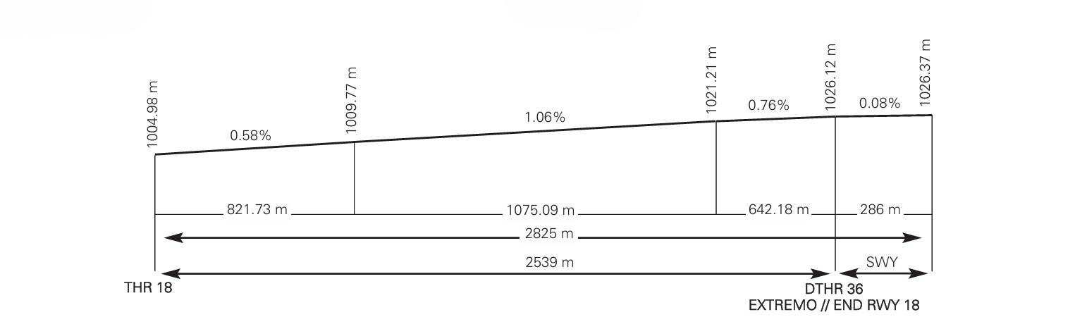
2539 x 45 |
402529.04N 0011305.89W |
THR: 1005 m / 3297 ft |
286 x 45 |
No |
2945 x 300 |
No |
150 x 184 |
RWY: ASPH |
36 (1) (2) |
357.58° GEO 356° MAG |
2825 x 45 |
402406.80N 0011301.34W |
THR: 1026 m / 3366 ft |
No |
No |
2945 x 300 |
No |
150 x 240 |
RWY: ASPH |
Remarks: (1) DTHR 286 m. (2) Start RWY 36 coordinates: 402357.53N 0011300.82W. |
||||||||||
Profile
DECLARED DISTANCES
RWY |
TORA (m) |
TODA (m) |
ASDA (m) |
LDA (m) |
|---|---|---|---|---|
18 |
2539 |
2539 |
2825 |
2539 |
36 (1) |
2825 |
2825 |
2825 |
2539 |
Remarks: (1) DTHR 286 m. |
||||
APPROACH AND RUNWAY LIGHTING
Runway |
18 |
|
Approach |
Simple, 420 m. LIH. |
|
PAPI (MEHT) |
3.2° (22.2 m / 73 ft). |
|
Threshold |
Green. |
|
Touchdown zone |
No. |
|
Runway centre line |
No. |
|
Runway edge |
2539 m: 1939 m white + 600 m yellow. LIH. (1) Distance between lights: 60 m. |
|
Runway end |
Red. |
|
Stopway |
Red. |
|
Remarks |
Turning on lighting by radio (frequency A/A 122.680 C). (1) Lighting Intensity regulable. |
Runway |
36 |
|
Approach |
Simple, 420 m. LIH. Threshold identification lights. |
|
PAPI (MEHT) |
3° (17.4 m / 57 ft). |
|
Threshold |
Green. |
|
Touchdown zone |
No. |
|
Runway centre line |
No. |
|
Runway edge |
2825 m: 286 m red + 1939 m white + 600 m yellow. LIH (1). Distance between lights: 60 m. |
|
Runway end |
Red. |
|
Stopway |
No. |
|
Remarks |
Turning on lighting by radio (frequency A/A 122.680 C). (1) Lighting Intensity regulable. |
OTHER LIGHTING, SECONDARY POWER SUPPLY
ABN/IBN |
No. |
|
WDI |
1 near THR 18, 1 near THR 36. LGTD. |
|
TWY lighting |
No. |
|
Apron lighting |
Floodlighting. |
|
Secondary power supply |
Engine generators that provide to all lighting systems a maximum switch-over time (light) of 12.5 seconds, according to Annex 14. |
|
Remarks |
None. |
HELICOPTER LANDING AREA
Position |
|
|
Elevation |
|
|
Dimensions, surface, maximum weight, marking |
|
|
Direction |
Direction of RWY 18/36, see item 12. |
|
Declared distances |
|
|
Ligthing |
Aiming point: No.
|
|
Remarks |
None. |
AIR TRAFFIC SERVICES AIRSPACE ATS AIRSPACE
Designation |
ATZ TERUEL (RMZ). |
|
Lateral limits |
Circle radius 5 NM centred ARP. |
|
Vertical limits |
SFC-2000 ft AGL. |
|
Airspace class |
G. |
|
Unit |
None. |
|
Transition altitude |
1850 m/6000 ft. |
|
Hours of applicability |
- |
|
Remarks |
None. |
AIR TRAFFIC SERVICES COMMUNICATION FACILITIESATS COMMUNICATION FACILITIES
Service |
Call sign |
FREQ |
HR |
Remarks |
|---|---|---|---|---|
No |
No |
122.680 C |
HR AD |
Only air/air communications. |
- |
- |
131.055 C |
HR AD |
AWOS system |
RADIO NAVIGATION AND LANDING AIDSRADIO NAVIGATION & LANDING FACILITIES
Facility (VAR) |
ID |
FREQ |
HR |
Coordinates |
ELEV DME |
Remarks |
|---|---|---|---|---|---|---|
No. |
- |
- |
- |
- |
- |
- |
LOCAL AERODROME REGULATIONSLOCAL REGULATIONS
Only VFR flights are allowed.
It is mandatory to carry radio communication equipment in both directions.
VFR flights will monitor on the frequency 122.680 C and will transmit their intentions, as well as the evolution of the different phases of their flight (position, levels and manoeuvre). This will allow aircraft to be aware of the situation of aerodrome traffic, in order to maintain appropriate separation where applicable.
Radio communications shall be carried out in English.
No airport aeronautical station will respond or acknowledge receipt of these communications.
DEPARTURES INTENDING TO CONTINUE AS IFR FLIGHTS
Departing VFR flights intending to continue their flight under IFR rules will formulate a "Z" flight plan and contact Madrid ACC at least 15 minutes before expected time of entry in controlled airspace, via telephone number 91-6785101/91-6566596 (Control room Supervisor) or via radio, frequency 133.850 MHz (Castejón Lower sector).
This communication does not replace the compulsory radio call to request, once airborne, clearance into controlled airspace.
OPERATIONS IN PUBLIC USE
The operator or pilot of the aircraft should make the request by contacting the CEOPS using the following channel:
-
E-mail: operaciones@aeropuertodeteruel.com, indicating the planned dates and times of the operation, as well as a contact e-mail address.
The CEOPS shall perform the communications to confirm the operation.
The submission of a flight plan is mandatory during public use hours, except for local flights.
Operations of microlight aircraft (ULM), sporting activities and gliders are not permitted during public use hours.
OPERATIONS IN RESTRICTED USE
The operator or pilot of the aircraft should make the request by contacting the CEOPS using the following channel:
The request should be made with a minimum advance notice of 4 hours before the hour of operation and should contain the following data:
-
Registration of the aircraft.
-
Flight class.
-
Type of aircraft.
-
Dates and times expected.
The CEOPS shall perform the communications to confirm the operation.
GROUND ENGINE TEST
Engine tests require prior airport authorization and they shall be carried out at THR 18.
Testing at idle regime may be carried out on the apron with prior authorization from the airport.
Requests for both tests shall be submitted via e-mail to: operaciones@aeropuertodeteruel.com
HELICOPTER OPERATION
As there is no defined specific area for helicopter operation, they will be treated and will carry out their operations as fixed-wing aircraft.
To access PRKG H11, H35 and H38, air taxiing shall be carried out via the inner apron taxiway until reaching the respective stand, entering the inner apron taxiway from Taxiway T or from the helicopter elevated taxiway. To exit from any of these stands, air taxiing shall likewise be carried out in the opposite direction via the inner apron taxiway.
NOISE ABATEMENT PROCEDURES
No.
FLIGHT PROCEDURES
LOW VISIBILITY PROCEDURES (LVP)
Low Visibility Procedures (LVP) are not available at Teruel airport.
AD TRAFFIC CIRCUIT

ADDITIONAL INFORMATION
BIRD CONCENTRATION AREA
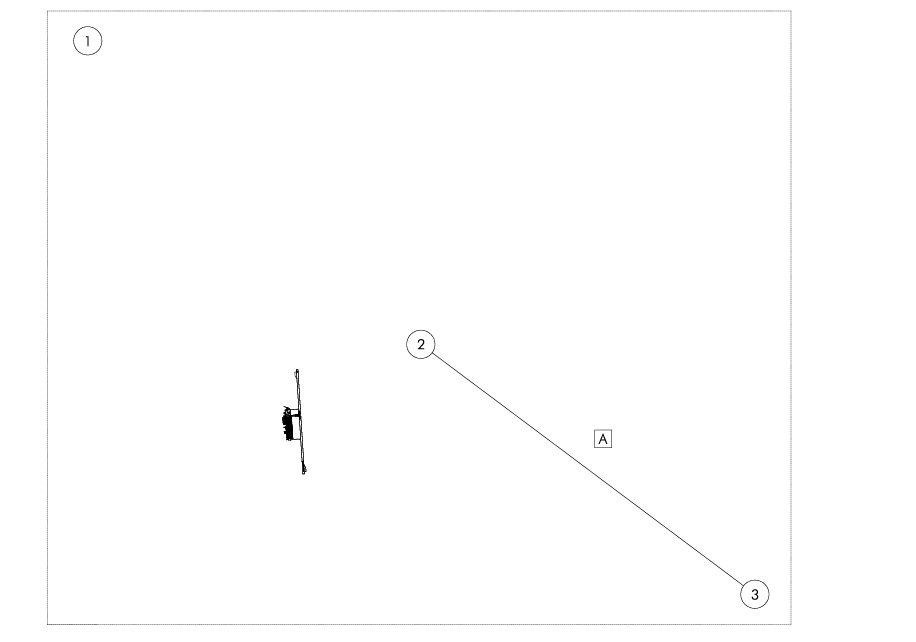
AREA 1: Laguna del Cañizar. Poultry fauna 11 km from the AD, which could contribute to the movement of migratory birds in a timely manner.
Area 2: Cerro Gordo ravine.
Area 3: Teruel landfill.
BIRD MOVEMENT
Movement A: Occasional movement of vultures at the Cerro Gordo ravine (6 km east of the AD) and Teruel landfill (13 km southeast of the AD).
AERONAUTICAL CHARTS RELATED TO AN AERODROMECHARTS RELATED TO THE AERODROME
The list of charts related to the aerodrome can be found on the link below:
VISUAL SEGMENT SURFACE (VSS) PENETRATION
Not applicable.