LEAG AD 3 HELIPORT DATA
HELIPORT LOCATION INDICATOR and- NAME
LEAG - ALGECIRAS
HELIPORT GEOGRAPHICAL AND ADMINISTRATIVE DATA
HRP |
360744N 0052628W. See AD 3-LEAG HELC. |
|
Distance and direction from the city |
0 km to the East. |
|
Elevation |
30 m / 97 ft. |
|
Geoid undulation |
42.86 m ± 0.05 m. (1) |
|
Reference temperature |
30ºC. |
|
Low average temperature |
12ºC. |
|
Magnetic variation |
1º W (2020). |
|
Annual change |
7.6’E. |
|
HLP administration |
Aena. |
|
Address |
Helipuerto de Algeciras, Estación Marítima s/n, Puerto Bahía de Algeciras (Muelle de la Galera), 11207 Algeciras (Cádiz). |
|
TEL |
+34-956 646 400 |
|
FAX |
+34-956 646 402 |
|
AFTN |
LEAG |
|
No. |
||
Approved traffic |
VFR (2) (3). |
|
Remarks |
(1) For all HLP points. |
OPERATIONAL HOURS
Heliport |
V: MON-FRI 0525-2010; SUN 1255-2010. |
|
Customs and Immigration |
HR HLP. |
|
Health and Sanitation |
No. |
|
AIS/ARO |
H24. (2) |
|
MET briefing |
HR HLP. |
|
ATS |
No. |
|
Fuelling |
No. |
|
Handling |
No. |
|
Security |
HR HLP. |
|
De-icing |
No. |
|
Remarks |
(1) For other operational hours, prior request, consult NOTAM in force. (2) Centralised ARO Office Geographical Area 14.
Oficina AIO Centralizada – Oficina NOTAM Internacional
|
HANDLING SERVICES AND FACILITIES
Cargo facilities |
No. |
|
Fuel types |
No. |
|
Oil types |
No. |
|
Refuelling capacity |
No. |
|
De-Icing facilities |
No. |
|
Hangar space |
No. |
|
Repair facilities |
No. |
|
Remarks |
None. |
PASSENGER FACILITIES
Hotels |
In the city. |
|
Restaurant |
No. |
|
Transportation |
Taxi. |
|
Medical facilities |
No. |
|
Bank/Post Office |
No. |
|
Tourist information |
Yes. |
|
Remarks |
None. |
RESCUE AND FIREFIGHTING SERVICES
Fire category |
H-3, HR HLP (1). |
|
Rescue equipment |
Yes, in accordance with the ICAO-SEI CAT. |
|
Removal of disabled helicopters |
External service for aircraft removal, with prior notice and charged to the owner/operator. Means available MAX: lifthing up to 7 Tm. |
|
Remarks |
(1) For other fire categories, prior request, consult NOTAM in force. |
SEASONAL AVAILABILITY -/OBSTACLE CLEARING
Equipment |
No. |
|
Priority |
No. |
|
Remarks |
None. |
Aprons, taxiways and check locations/positions dataMOVEMENT AREA DETAILS
Apron |
Surface: No. |
|
Stands |
Surface: No. |
|
Taxiways |
Width: No. |
|
Check locations |
Altimeter: TLOF: 30 m / 97 ft. |
|
Remarks |
None. |
MARKINGS AND MARKERS
Final approach markings |
Heliport identification, maximum allowable mass. |
|
Take-off markings |
Touchdown and lift-off area. |
|
TWY markings |
No. |
|
TWY markers |
No. |
|
Air Transit Route markers |
No. |
|
Remarks |
None. |
HELIPORT OBSTACLES
Obstacles which penetrate Approach, Take-Off Climb, Conical, Inner Horizontal, Transitional, Inner Transitional and Balked Landing Surfaces established in ICAO Annex 14; and the areas 2A and 3 established in ICAO Annex 15. Those penetrating these surfaces are identified in the CSV file as “Relevante_Relevant = Si/Yes”. |
See Item 10 and Data Set.Digital Data section. |
|
Remarks |
See AD 3-LEAG AOC. |
METEOROLOGICAL INFORMATION SERVICE PROVIDED
MET office |
No. |
|
HR |
No. |
|
METAR |
Automatic (on frequency 123.425 MHz, transmitting automatically every 20 SEC in English and 20 SEC in pause). H24 half-hourly. Information issued about: wind speed and direction, visibility, current weather (precipitation, fog, mist and haze), cloud amount, height of cloud base, air temperature, dew point and QNH. Information about: type of clouds, storms, freezing precipitation and freezing fog, is not issued. |
|
TAF |
24 HR. |
|
TREND |
No. |
|
Briefing |
No. |
|
Flight documentation/Language |
No. |
|
Charts |
No. The Heliport has a terminal to access the Autoservicio Meteorológico Aeronáutico (AMA) of AEMET that contains the necessary meteorological information for flight planning. |
|
Supplementary equipment |
No. |
|
ATS unit served |
None. |
|
Additional information |
Sevilla OMAe (LESV): H24
|
|
Remarks |
The local meteorological information provided according to the METAR AUTO key is generated automatically without human intervention, in either generation or validation. Therefore, caution is recommended in the use of the information about visibility, current weather, cloud amount and height of cloud base, due to the limitations of the sensors, the spatial area sampled by these sensors, as well as the associated algorithms used by the automatic observation system. |
HELIPORT DATA
Type of heliport |
Elevated heliport. |
|
TLOF |
Dimensions: 32 x 24 m. |
|
FATO |
Magnetic heading: 054º-234º. |
|
Safety area dimensions |
48 x 34 m. |
|
Heliport CWY dimensions |
No. |
|
Obstacle-free sector |
No. |
|
Remarks |
D-value: 17 m. |
DECLARED DISTANCES
| FATO | TODAH (m) | RTODAH (m) | LDAH (m) |
|---|---|---|---|
| 05 | 32 | 32 | 32 |
| 23 | 32 | 32 | 32 |
| Remarks | None. | ||
APPROACH AND FATO LIGHTING
FATO |
05. |
|
Approach |
No. |
|
APAPI (MEHT) |
6º (INFO NO AVBL). |
|
FATO lighting |
Characteristics: No. |
|
Aiming point lighting |
Characteristics: No. |
|
Remarks |
None. |
|
FATO |
23. |
|
Approach |
No. |
|
APAPI |
No. |
|
FATO lighting |
Characteristics: No. |
|
Aiming point lighting |
Characteristics: No. |
|
TLOF lighting |
Characteristics: Omnidirectional green. |
|
Location |
Edge. |
|
Remarks |
Lighting available on 123.325 MHz frequency: |
OTHER LIGHTING, SECONDARY POWER SUPPLY
Heliport beacon |
Yes. |
|
WDI |
1 near THR 05, 1 near THR 23. LGTD. |
|
Apron lighting |
Characteristics: No. |
|
Secondary power supply |
Engine generators that provide a maximum switch-over time (light) of not more than 15 seconds to all the lighting systems. |
|
Remarks |
See item 14 remarks. |
Air traffic services airspaceATS AIRSPACE
|
Designation | No. |
Lateral limits |
- | |
Vertical limits |
- | |
Airspace class |
- | |
Unit Language |
- | |
Transition altitude |
- | |
Hours of applicability |
- |
|
Remarks |
None. |
Air traffic services communication facilitiesATS COMMUNICATION FACILITIES
Servicio |
Distintivo llamada |
FREQ |
HR |
Observaciones |
|---|---|---|---|---|
No |
No |
123.325 MHz |
HR HLP |
HLP without ATS service. |
123.425 MHz |
HR HLP |
AWOS system. |
||
RADIO NAVIGATION and landing aidsfacilities
| Instalación (VAR) | ID | FREQ | HR | Coordenadas | ELEV DME | Observaciones |
|---|---|---|---|---|---|---|
| No. | - | - | - | - | - | - |
LOCAL heliport REGULATIONS
The mandatory flight plan submission is an operative condition for aircraft taking off or landing at this heliport. It can only be used by one helicopter at a time. FATO 23 take-off is limited to class 1 helicopters, forbidden for class 2 and 3 helicopters, as per technical design standards and operation of public use airports VOL II 4.1.19 RD 862/2009.
REPORTING DEPARTURES AND ARRIVALS
The departure/arrival of flights from/to Algeciras must be reported to the Centralised ARO by the pilot in command of the aircraft.
NOISE ABATEMENT PROCEDURES
No.
FLIGHT PROCEDURES
For performance 1 helicopters, as per aircraft manual of the aircraft.
LOW VISIBILITY PROCEDURES (LVP)
Low Visibility Procedures (LVP) are not available at Algeciras heliport.
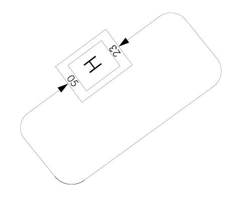
HLP TRAFFIC CIRCUIT
ADDITIONAL INFORMATION
In the vicinity of the heliport there are migratory routes crossing the Strait of Gibraltar causing significant concentrations of birds, at different heights, usually coinciding with the months of February and March in migratory flows from North to South, and in September and October in the flows from South to North, although these periods may be earlier or later, depending on general weather conditions.
Caution due to bird concentration throughout the year.
It is mandatory to file a flight plan for VFR flights by commercial air carriers which operate at Algeciras heliport. Caution due to presence of seagulls in the vicinity of the heliport.
Charts related to a heliportCHARTS RELATED TO THE HELIPORT
The list of charts related to the heliport can be found on the link below:
VISUAL SEGMENT SURFACE (VSS) PENETRATION
No.